Knowing the exact limits of your land is essential when you’re building, fencing, or resolving property questions. A boundary survey clearly identifies where your legal boundary sits and helps avoid costly mistakes or disputes. This guide explains what a boundary survey is, when you need one, and how it applies to property owners across Lake Macquarie, Newcastle, Maitland, Cessnock and the Central Coast.
What Is a Boundary Survey?
A boundary survey is a professional assessment conducted by a licensed surveyor to establish the exact legal boundaries of your land. Unlike general land surveys, this focuses specifically on determining the perimeter lines based on legal documents, historical data, and physical markers on the land. The survey results in a detailed plan that clearly defines the property limits, which are legally recognised and can be used in ownership disputes or development practices.
Why Are Boundary Surveys Important?
A boundary survey confirms exactly where your legal boundary sits. This helps prevent fence disputes, avoids building in the wrong place, and gives you certainty when buying, selling, or planning work on your land. If you plan to build fences, walls, extensions or additions knowing your true property line helps prevent costly mistakes. When Do You
Need a Boundary Survey?
Several scenarios that may require commissioning a boundary survey for your property:
- Buying or Selling Property: To verify the exact limits ensuring a smooth transaction.
- Fence or Wall Installation: To avoid building on someone else’s land.
- New Construction or Extensions: To comply with regulations and avoid boundary infringements.
- Disputes With Neighbours: To resolve disagreements about boundary lines or easements.
- Land Encroachment Investigations: To investigate and document illegal use of land.
How Is a Boundary Survey Performed?
- Research: Your surveyor will gather historical documents including title deeds, deposited plans, and previous surveys.
- Field Work: They perform precise on-site measurements using GPS, total stations, and other advanced equipment.
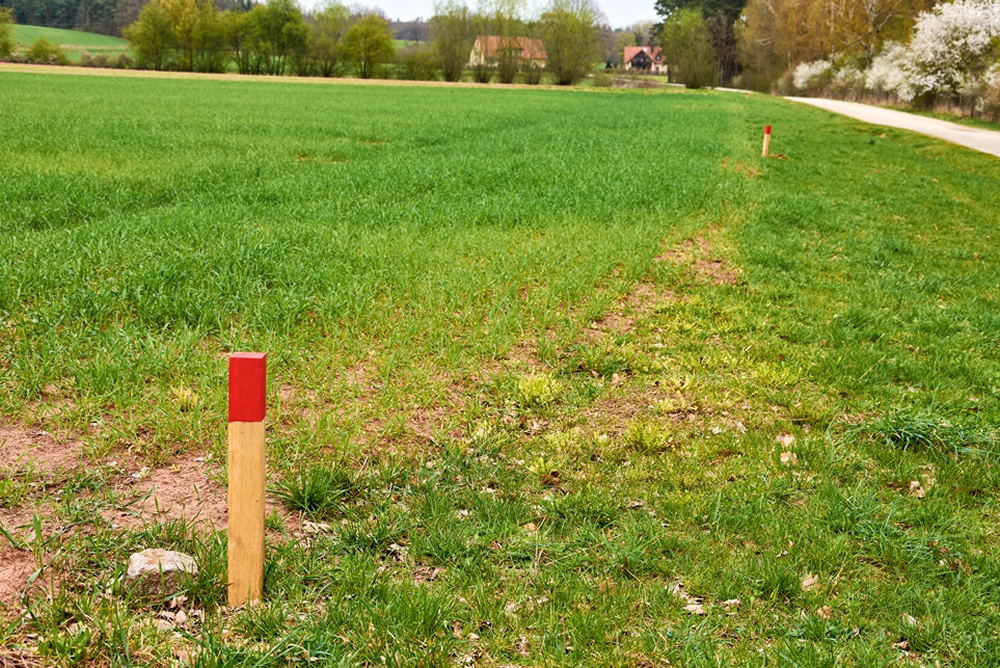
- Marking: Existing boundary markers are identified, or new markers such as pegs or iron pins are placed.
- Mapping: The data is compiled into an accurate survey plan showing the legally recognised limits of the parcel.
- Certification: Final plans come with a registered licensed surveyor’s signature confirming legality.
Who Can Perform a Boundary Survey?
Only a registered land surveyor with expertise in boundary law and land measurement can legally conduct boundary surveys in Australia. Their qualifications and registration rights give validity to the survey plan and protect your investment and property rights.
Benefits of a Professional Boundary Survey
- Legal Certainty: Establishes indisputable property limits.
- Avoids Disputes: Clarifies boundaries before conflicts arise.
- Supports Development: Ensures compliance with local council and planning laws.
- Increases Property Value: Verified boundaries add buyer confidence.
Common Types of Boundary Surveys
Boundary surveys come in various forms, each designed for specific purposes to meet the unique needs of landowners, developers, and builders across Lake Macquarie, Newcastle, the Central Coast and surrounding Hunter regions.
Basic Boundary Survey
A basic boundary survey establishes the legal limits of your property, precisely marking your land’s perimeter as defined by legal documents and physical features. This survey helps confirm ownership and prevent encroachments. It is essential when buying or selling property, resolving disputes, or planning developments.
Learn more about our Boundary Survey services for detailed coverage and local expertise.
Subdivision Survey
A subdivision survey legally divides a larger parcel of land into multiple smaller lots, preparing the land for sale or development. This survey involves creating detailed subdivision plans compliant with council and NSW Land Registry Services requirements.
Subdivision surveys are crucial when you want to develop new townhouses or separate property titles, particularly common in urban and regional areas like Maitland and Cessnock.
Explore our expert Subdivision Survey offerings to guide your next property division project.
Fence Location Survey
Fence location surveys identify the correct legal placement of a fence or boundary wall so you can build confidently and avoid future issues. These surveys are commonly used when neighbours want clarity before installing a fence or when the existing fence line appears out of alignment. This is particularly important in established residential areas across Lake Macquarie, Newcastle, and the Hunter.
This type of survey is especially valuable when you plan new fencing installations or boundary reinforcements.
Identification Survey
An encroachment survey identifies any illegal or unintended use of land boundaries by structures such as fences, sheds, or driveways that cross property lines. Recognising encroachments early helps prevent costly disputes and legal complications.
Property owners across Lake Macquarie, Newcastle, Maitland, Cessnock, and the Central Coast commonly request this type of survey when they want clarity about structures crossing or nearing a boundary.
Related Surveys
- Topographical Detail Survey: Captures elevation, contours, and physical features to assist planning and development (see Topographical Detail Survey).
- Construction Set Out Survey: Guides builders in placing structures accurately on site according to design plans (see Construction & Building Survey).
- Identification Survey: Confirms building or structure positions relative to property boundaries, critical after construction (see Identification Survey).
This comprehensive understanding of boundary survey types and related services ensures property owners and developers in Lake Macquarie, Newcastle, Central Coast, and other NSW regions make informed decisions backed by legal certainty and expert surveying guidance.
The Australian Government provides comprehensive guidelines on land boundaries — visit Lands NSW Boundary Definition Guidelines.
Where Does MJM Surveying Provide Boundary Survey Services?
MJM Surveying provides boundary surveys across Lake Macquarie and surrounding regions, including:
- Lake Macquarie
- Newcastle
- Central Coast
- Maitland
- Cessnock
- Hunter Valley
- Singleton
- Dungog
Whether you are situated in a coastal suburb or rural land within these regions, our local expertise and knowledge ensure precise surveying tailored to your area’s specific requirements.
Frequently Asked Questions (FAQs)
- How long does a boundary survey typically take?
A typical residential boundary survey can usually be completed quickly, with final plans delivered once all measurements and checks are completed. Timeframes vary depending on the size of the land, access, and available historical information. - How much does a boundary survey cost?
Cost varies based on property size, terrain, and survey complexity; expect quotes after initial site inspection. - Can a boundary survey resolve neighbour disputes?
Yes, a professional survey provides legal proof of boundaries to settle disputes amicably or in court. - What happens if boundary markers are missing?
Surveyors use legal records and physical clues to re-establish lost markers according to law. - How often should boundary surveys be updated?
Update your boundary survey before major property transactions, developments, or if disputes arise. - Do I need a boundary survey when buying land?
It’s highly recommended to avoid purchasing land with unclear or disputed boundaries. - Can boundary surveys help with fencing a property?
Absolutely, they ensure fences don’t encroach on neighbouring land or council properties. - Are boundary surveys mandatory for subdivisions?
All new property boundaries that result from a subdivision require marking as per the Spatial & Spatial Information Regulation 2024. - What’s the difference between a boundary survey and a title search?
A title search reviews legal ownership records; a boundary survey maps physical land limits. - Can I perform my own boundary survey?
Due to legal requirements and technical skills, it’s essential to hire a licensed surveyor.
Consult Now
If you’re in Lake Macquarie, Newcastle, Central Coast, or neighbouring NSW regions and require a professional boundary survey, contact MJM Surveying today. Our experienced team offers precise, affordable surveys ensuring your property rights and project compliance. Request your free quote or consultation now.